
FEATURES & BENEFITS
- Easy data management
- Fast and powerful processing
- Quality assurance
- Complete survey project control
OVERVIEW
Survey Office software is ideal for processing and analyzing GPS and GNSS, and optical survey data recorded in the field, and exporting it to a design package. The software provides numerous innovative and unique features, and it is easy to learn and use. With Survey Office software on your PC you have the ability to work with RTK and Static/PPK data to generate reports as well as identify and correct field errors. Import data from existing surveys or directly from the Internet and export data as points, or in CAD or XML format. Rest assured that your data is secure and reliable with built-in quality assurance and quality control features. The intuitive, integrated Survey Office program saves time with its short learning curve and powerful features.
Survey data acquired in the field using a total station and contained in a data file can be imported into the software and integrated as necessary with other data collected as part of a survey project (for example, GNSS or level data).
Survey data acquired in the field using a total station and contained in a data file can be imported into the software and integrated as necessary with other data collected as part of a survey project (for example, GNSS or level data).
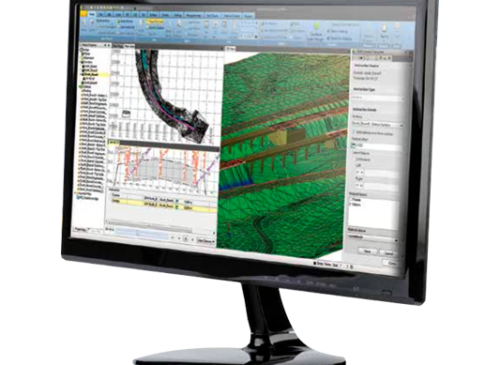
The Survey Office software is powerful and configurable, yet easy-to-use. The user interface features options that are familiar to Microsoft Office users. Drag-and-drop compatible files from your computer directly into an open project and the Survey Office software analyzes the file to determine its type and how it needs to be processed. Visualization tools such as Plan views, 3D views, time-based data views and session editors help you “see” the data in the context of the entire project.
The Survey Office software provides surveyors and engineers with advanced technology, integrating common tasks into a single system. Process and review RTK, Static, FastStatic, and stop-and-go Kinematic data. Survey Office also performs data reduction, computation, QA/QC and network adjustment. Control data can be exported to the field software for use in the field.
Survey Office v5.30 position itself as the single office software for surveyors professionals.
Manage and exchange data seamlessly:
CAD command line
Point feature extraction
Tunneling workflow enhancements
Scanning and surface tools
And much more!
Survey Office v5.30 position itself as the single office software for surveyors professionals.
Manage and exchange data seamlessly:
And much more!
DOWNLOADS
Our Address
Dubai Office
Falcon Geomatics LLC
Ahammed Kamal Warehouse 6
Street 10C
Ras al Khor Industrial 1, Dubai
United Arab Emirates
Abu Dhabi Office
Falcon Geomatics LLC – Abu Dhabi
Musaffah Industrial Area M40
Plot Number 6 & Building 3
First Floor, Office No. 11 & 12
Abu Dhabi
United Arab Emirates
Quick Contact
Copyright © 2026, Falcon Geomatics LLC – All Rights Reserved.